
Introduction
Elba Island boasts more than 400 km of marked trails weaving through chestnut woods, rocky ridges and panoramic cliffs overlooking the Tyrrhenian Sea . This guide, prepared by the team at Hotel Giardino in Lacona, outlines the island’s most beautiful walks, grouping them by difficulty and providing practical advice. Elba’s trail network offers something for everyone: from gentle coastal paths perfect for families to challenging via ferratas for experienced hikers. Throughout the guide you will find questions and answers, comparison tables and notes based on local expertise.
Practical tips for hiking on Elba
Before lacing up your boots, it’s important to pack appropriately and understand the best seasons for hiking:
- What to pack: Wear sturdy hiking shoes with a grippy sole and dress in layers—breathable T‑shirt, fleece or sweatshirt and waterproof jacket. In summer, bring a hat and sunscreen (the south‑facing beaches like Lacona receive strong sun). Carry a light backpack with 1.5–2 litres of water per person, energy snacks or dried fruit, a map (printed or on GPS/smartphone), a multipurpose knife and a basic first‑aid kit . Trekking poles help on steep descents. In isolated areas or when returning at dusk, a headlamp is useful .
- When to go: The Mediterranean climate allows walking all year, but the best seasons are spring (April–June) and autumn (September–October) when temperatures are mild and the vegetation is lush . Summer (July–August) can be very hot, especially on the south side like Lacona; start at dawn and avoid midday heat . In winter, the plains remain mild, but fog, rain or occasional snow can affect higher peaks such as Monte Capanne (1019 m) .
- Safety and etiquette: Check the local weather forecast before heading out; strong winds or sudden storms can make hiking unsafe . Inform someone of your route and expected return time, and choose trails suited to your fitness level . Stay on marked trails to protect flora and fauna and avoid getting lost . Carry enough water and snack regularly to prevent fatigue . If conditions worsen or someone feels unwell, turn back or modify the itinerary . In case of emergency call 112 or 118 . Respect the natural environment: do not light fires, leave no rubbish and avoid damaging vegetation. Wild camping is forbidden, and motorised vehicles are not allowed on trails .
Easy and family‑friendly walks
For beginners and families with children, Elba offers several flat or gently undulating paths that showcase the coast and countryside. These routes are well sign‑posted and take between one and two hours. A summary table follows the descriptions.
Sentiero della Salute (Biodola – Procchio)
This 3–4 km coastal path links the golden beaches of Biodola and Procchio on the north coast. It’s essentially flat and passes through Mediterranean scrub with occasional sea views . Return along the same route for a total walking time of less than two hours; the trail is ideal for young children.
Passeggiata Carmignani (Porto Azzurro – Barbarossa)
Connecting the harbour town of Porto Azzurro with the small Barbarossa bay, this 3–4 km path runs along the eastern shore. It traverses pine woods with beautiful views of the Tyrrhenian Sea and has sections equipped with handrails, making it safe for children .
Laghetto di Terranera
Starting from Barbarossa beach near Porto Azzurro, this loop reaches the Terranera coastal lagoon—an old mining basin ringed by pine trees. The easy walk is 5–7 km long and takes about two hours. It’s perfectly flat and suitable for families who want to learn about the island’s mining history and spot water birds .
Anello di Capo d’Enfola
This 5–6 km circular trail encircles the headland north of Portoferraio. The route is not strenuous and offers sweeping sea views and remnants of Spanish fortifications . Sea breezes make it pleasant even on hot days .
Anello di Monte Perone
Located near the hamlet of Poggio, this 3 km loop around Monte Perone (about 440 m) winds through pine and holm‑oak forests and offers glimpses of Lacona and Porto Azzurro . Although not marked by the CAI, it is safe and popular with families.
Table: Easy/family‑friendly trails
| Trail | Starting point | Length (return) | Approx. duration | Difficulty | Main features |
|---|---|---|---|---|---|
| Sentiero della Salute | Biodola beach | ~4 km | 1–1.5 h | Easy | Flat coastal path between two sandy beaches |
| Passeggiata Carmignani | Porto Azzurro | ~4 km | 1–1.5 h | Easy | Pine woods; connects town to Barbarossa beach |
| Anello di Capo d’Enfola | Portoferraio | ~6 km | ~2 h | Easy | Panoramic loop around the headland; sea views and fort ruins |
| Laghetto di Terranera | Barbarossa beach | 6–7 km | ~2 h | Easy | Flat, sign‑posted loop to a coastal lagoon |
| Anello di Monte Perone | Poggio – Monte Perone | ~3 km | ~1 h | Easy | Forest trail with views of Lacona and Porto Azzurro |
These routes are marked T or E on CAI scales (Turistico or Escursionisti), meaning they are suitable for all walkers .
Advanced and expert trails
For fit hikers seeking more demanding adventures, Elba’s mountains and ridges offer challenging ascents, via ferratas and multi‑day treks. Only attempt these if you are properly equipped and experienced.
Via Ferrata del Monte Capanne (CAI #100)
Elba’s only via ferrata climbs from Monte Perone (597 m) to the summit of Monte Capanne (1019 m) along a 3.5 km path with a 340 m elevation gain . Classified EEA (Escursionisti Esperti Attrezzati), it includes exposed sections, fixed ladders and metal cables; hikers need a helmet, harness and via ferrata kit . Allow 3–4 hours for the ascent and enjoy spectacular views over the northern part of the island .
Grande Traversata Elbana (GTE)
Elba’s longest trek crosses the island from Cavo in the north‑east to Pomonte in the west. Roughly 100 km long, it requires four to seven days to complete and demands excellent physical fitness . The trail spans chestnut forests, grassy highlands and the south‑western coast, with alternating panoramic sections and high‑altitude mule tracks . Beginners can walk individual sections—detailed below—rather than tackling the whole route.
Via della Lavanda (Sant’Andrea – Colle d’Orano – Pomonte)
Part of the “Via dell’Essenza” network, this demanding segment runs roughly 15–16 km along the ridge rising to Monte Capanne . Starting near Sant’Andrea on the north‑west coast, it heads south over Colle d’Orano and down to Pomonte on the west coast. Expect 600 m of cumulative ascent and spectacular views of the sea and Corsica; allow 6–8 hours .
Itinerario dei Nidi d’Aquila (Rio nell’Elba – Volterraio)
This 5–6 hour route follows rocky slopes up Monte Volterraio from the village of Rio all’Elba towards Rio Marina. While it isn’t a true via ferrata, it includes exposed sections on compact rock that demand sure‑footedness and no vertigo . The name “Eagles’ Nests” recalls the fortress‑like ruins on the summit.
Other challenging routes
- Monte Capanne ascent on foot: Hiking from the Monte Capanne cable‑car station to the peak takes about 4–5 hours .
- Sentiero del Mirto (Procchio – Marciana): About 18 km long with long climbs and descents; rated for experienced hikers .
- Colle d’Orano – Pomonte – Seccheto: A 13 km route along the south‑western ridge with steep climbs and dramatic sunsets .
- Other ridge paths: These include the ancient iron‑ore path from Rio Marina to Porto Azzurro and the Camaiore–Fetovaia section of the Via dell’Essenza, both reserved for trained hikers .
Table: Medium/high‑difficulty trails
| Trail | Starting point | Length | Duration | Difficulty | Notes |
|---|---|---|---|---|---|
| Via Ferrata del Monte Capanne (#100) | Monte Perone (597 m) | 3.5 km | 3–4 h | EEA (very high) | Equipped via ferrata requiring harness; breathtaking views of Elba |
| Grande Traversata Elbana (GTE) | Cavo / Pomonte | ~100 km | 4–7 days | Experienced | Cross‑island trek; variable terrain; physically demanding |
| Via della Lavanda | Sant’Andrea / Pomonte | ~16 km | 6–8 h | Challenging | Part of the Via dell’Essenza; 600 m elevation; sea and Corsica views |
| Nella Terra del Ferro | Rio nell’Elba | ~10 km | ~4 h | Medium | Paths on old mining mule tracks to Monte Giove fortresses |
| Colle d’Orano – Pomonte (Via del Mirto/Erica) | Sant’Andrea | ~12 km | 5–6 h | Challenging | Ridge path with long climbs and sunset vistas |
Frequently asked questions
- Which trail is the most scenic and difficult? The Grande Traversata Elbana is Elba’s signature trek, spanning about 100 km coast‑to‑coast . It should be split into 4–7 stages and is best for experienced hikers who want 360° views over the island and neighbouring archipelago . For a one‑day challenge without via ferrata, consider the Via Ferrata del Monte Capanne (#100) .
- Are there trails suitable for beginners and children? Yes, the Sentiero della Salute, Passeggiata Carmignani, Anello di Capo d’Enfola and Laghetto di Terranera are all short, flat and scenic . These walks take one to two hours and require no special skills .
- What gear is required for medium‑difficult trails? Hikes of 10–20 km with significant elevation changes demand sturdy shoes, maps or GPS and good training . The Via Ferrata del Monte Capanne requires a helmet and via‑ferrata kit .
- How does CAI classify the trails? Italian Club Alpino Italiano (CAI) grades hikes as T (Turistico – easy), E (Escursionisti – medium), EE (Escursionisti Esperti – demanding) and EEA (Escursionisti Esperti Attrezzati – via ferrata) . CAI signposts at trailheads indicate the grade and approximate times.
- What to do in bad weather? Do not push on if the weather worsens. Stop, assess and, if necessary, turn back along the known path . Always have a “plan B” and a map; suspend the hike in case of heavy rain or fog .
- Where to find maps and guides? Official Elba trail maps are available at the National Park visitor centres (for example, in Lacona) or can be downloaded as GPX files . The park’s “Isola d’Elba Trekking” app offers updated interactive maps, and the CAI website provides downloadable routes . Always carry a paper map as phone coverage may be patchy.
- Can I hike with a dog? Yes, many trails permit dogs on a leash. Avoid protected dune areas where animals might disturb sensitive species . Hotel Giardino is pet‑friendly and has a large garden where your four‑legged companion can rest after a walk .
Hotel Giardino: Your trekking base
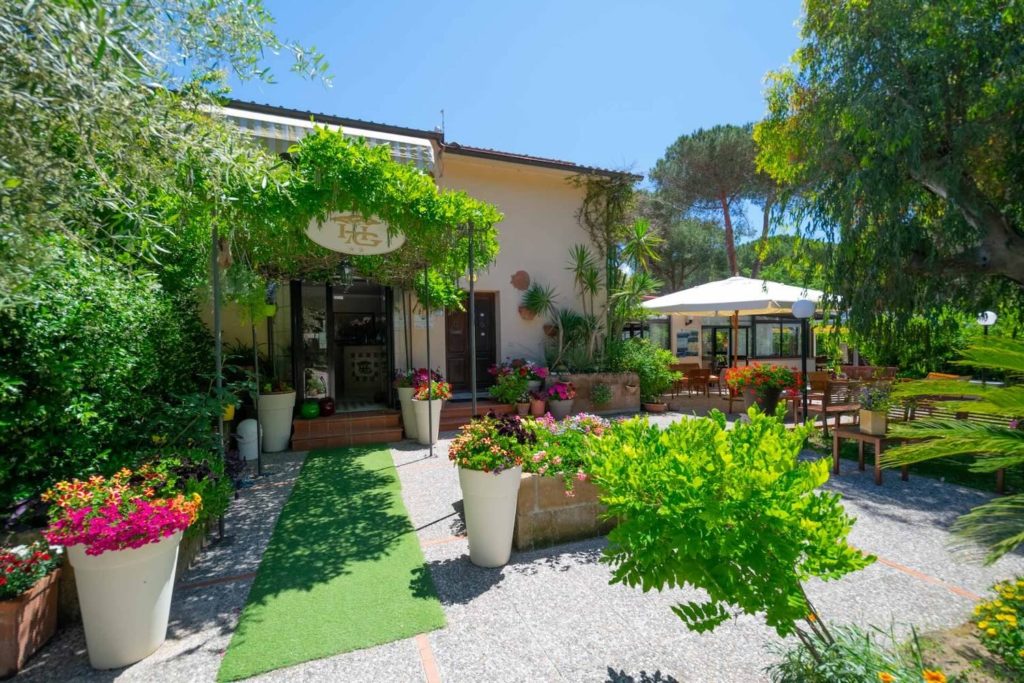
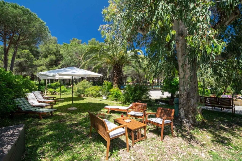
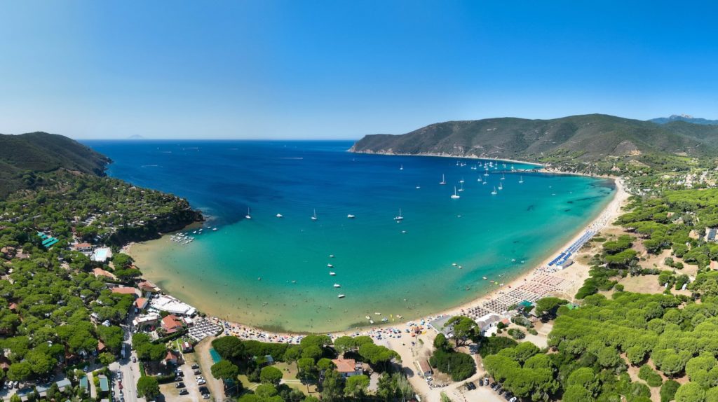
Nestled in the heart of the Gulf of Lacona (Capoliveri municipality), Hotel Giardino sits just 100 m from Lacona’s long sandy beach . The family‑run property is surrounded by a 30 000 m² park filled with pine and Mediterranean flora, providing a cool retreat after a day on the trails . From the hotel you can drive to Marina di Campo, Capoliveri, Porto Azzurro and Portoferraio in 10–15 minutes, making it easy to explore both the southern and northern sides of the island . The hotel features a secure bike room and collaborates with local sporting events, demonstrating a focus on hikers and cyclists .
Facilities for hikers
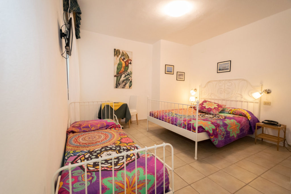
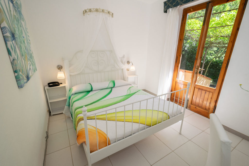
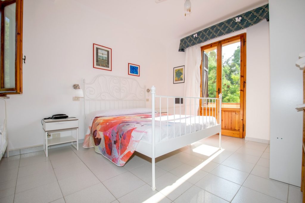
- Comfortable rooms: Simple yet functional, with air‑conditioning, TV, safe and private bathroom; some have patios or balconies. Cleaning is meticulous and the atmosphere is friendly.
- Local cuisine: Breakfasts feature fresh homemade products; lunches and dinners highlight Elban and Tuscan recipes prepared daily, with options for children and guests with dietary restrictions .
- Convenient services: Free Wi‑Fi in communal areas, secure bike storage and discounted ferry tickets . Staff provide detailed information on local trails, and there’s a large outdoor courtyard to relax after hikes .
Exploring the area around the hotel
After a trek, there are numerous natural and cultural attractions near Lacona:
- Lacona beach: A 1.2 km sandy bay with shallow, clear water—perfect for families and a base for easy coastal walks . Behind the beach lies a protected dune system with rare sea lilies (Pancratium maritimum) .
- Nearby coves: Short walks or drives lead to the small inlets of Laconella, Norsi and Margidore for snorkelling and quiet sunbathing . East of Lacona the Capo di Stella headland offers a trail down to a hidden bay with emerald waters .
- Monte Calamita: North of Capoliveri rises this 391 m massif, famous for its former iron mines. The Anello del Calamita trail explores the mining hills and provides views over the gulf .
- Monte Perone: The 443 m hill near Poggio has a loop path offering panoramic views over the island’s south coast .
- Sentiero del Pastore: A short circular path near Capoliveri with sea views, suitable for children .
- Religious sites: In the chestnut woods of Marciana you’ll find the Romitorio di San Cerbone and the Via Crucis leading to the Santuario della Madonna del Monte, steeped in history .
- Nearby towns: Capoliveri is a picturesque hilltop village with narrow streets, lively squares and a medieval fortress. Porto Azzurro features the Spanish Fort San Giacomo and the small lake of Terranera . Portoferraio (20–30 min by car) houses Napoleon’s residences and Medici forts . Marina di Campo has the island’s longest sandy beach and an aquarium .
Conclusion
The itineraries in this guide represent some of Elba’s finest treks, chosen for scenic beauty and ecological diversity . Based at Hotel Giardino, nestled in the natural setting of Lacona, you have the perfect starting point for both easy family walks and demanding mountain journeys . By packing properly, respecting the environment and selecting routes suited to your abilities, your hikes on Elba will be safe and unforgettable. From forests scented with rosemary to sunsets over the sea, Elba offers a deep immersion in the unspoilt nature of the Tuscan Archipelago.